 ar
ar bg
bg hr
hr cs
cs da
da nl
nl fi
fi fr
fr de
de el
el hi
hi it
it ko
ko no
no pl
pl pt
pt ro
ro ru
ru es
es sv
sv tl
tl iw
iw id
id lv
lv lt
lt sr
sr sk
sk sl
sl uk
uk vi
vi et
et hu
hu th
th tr
tr fa
fa ms
ms hy
hy ka
ka ur
ur bn
bn mn
mn ta
ta kk
kk uz
uz ku
ku
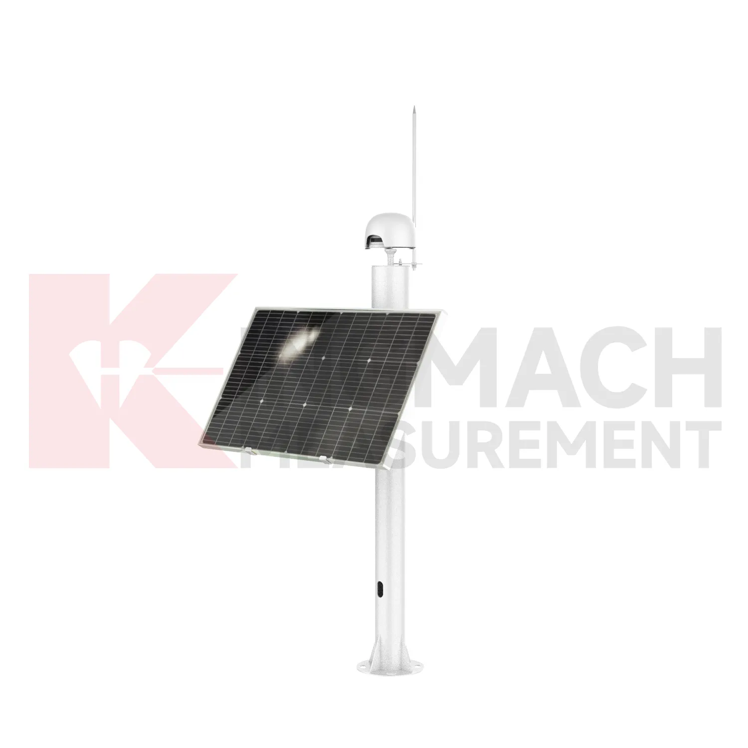
Integrated GNSS
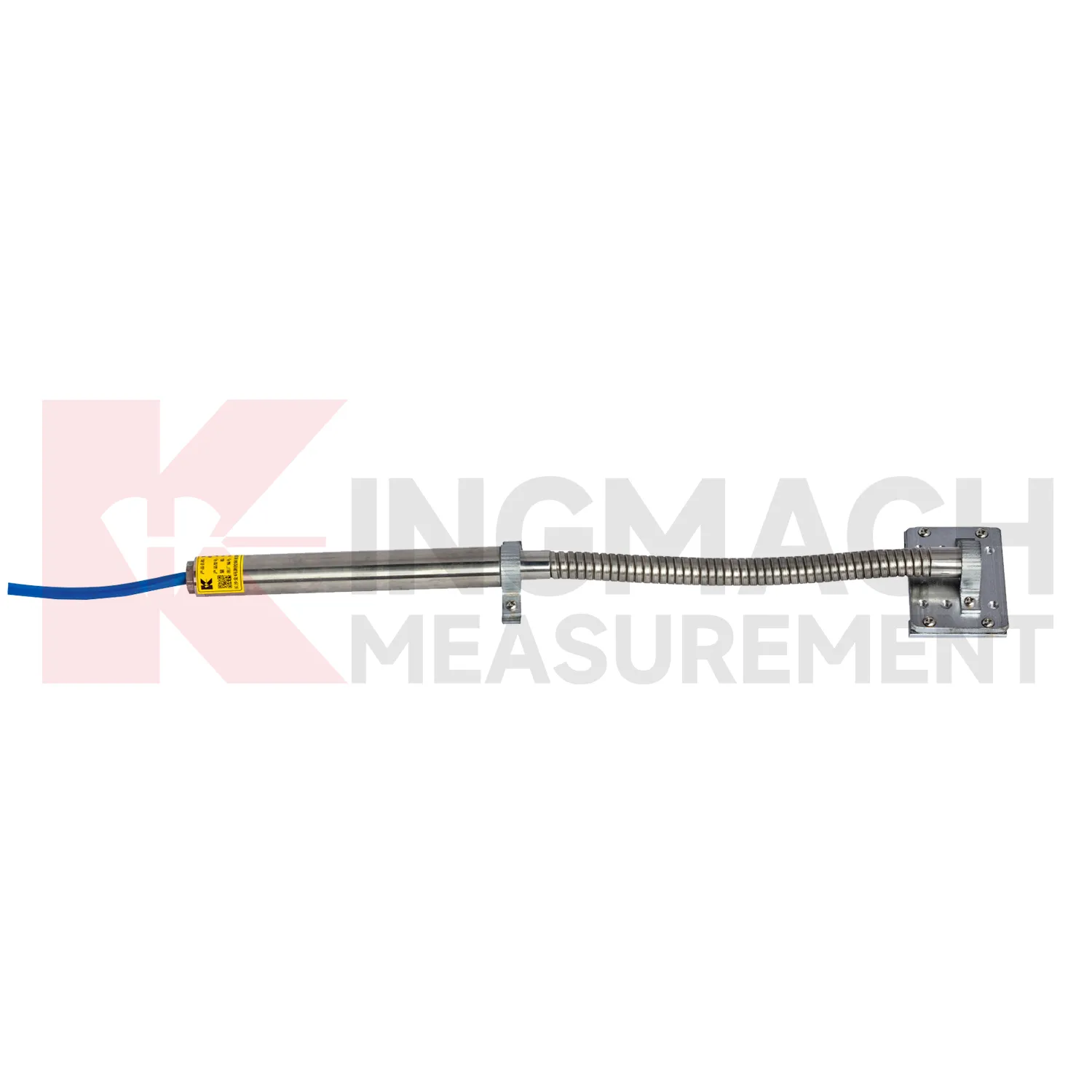
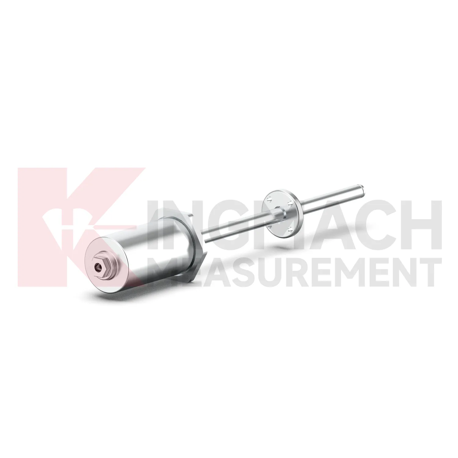
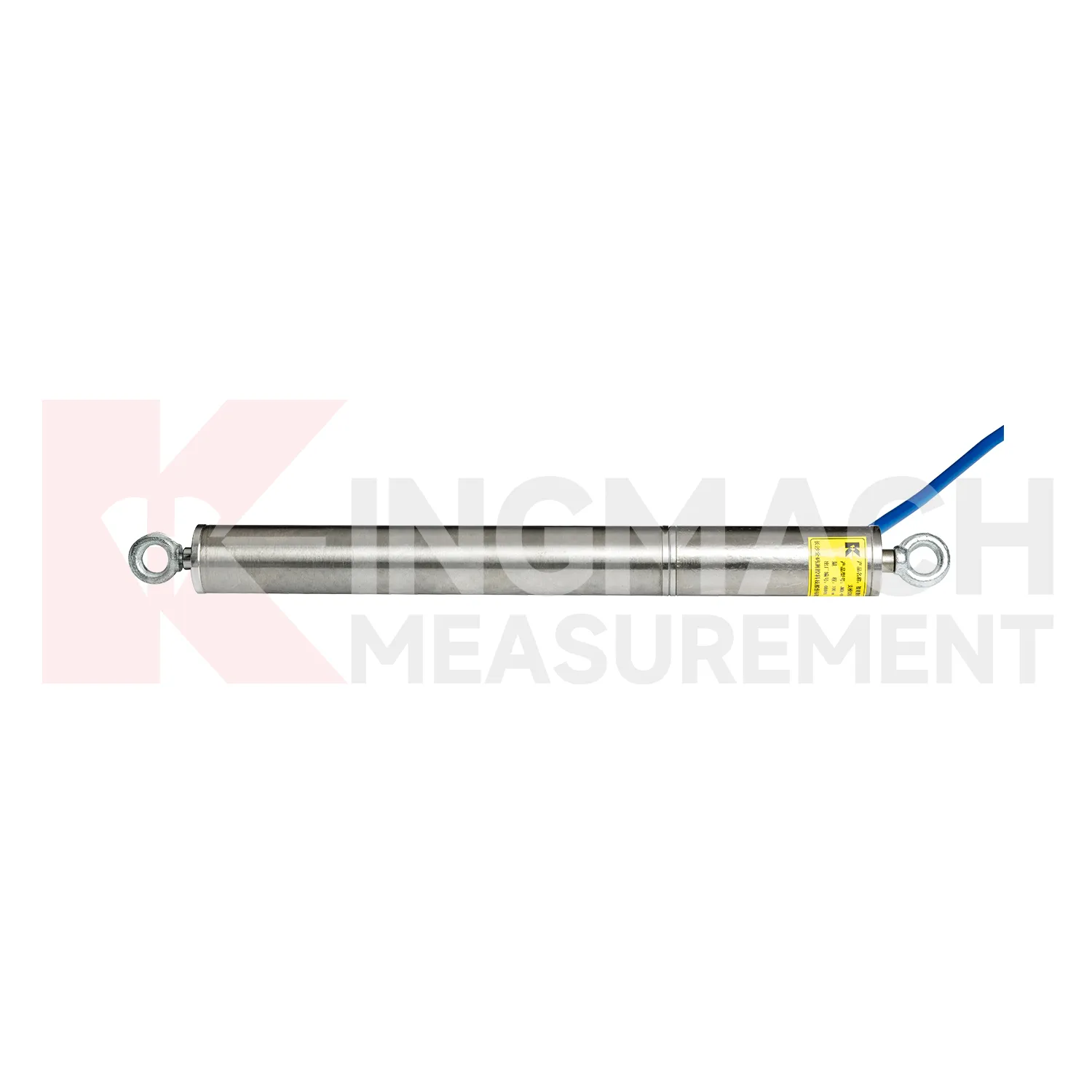
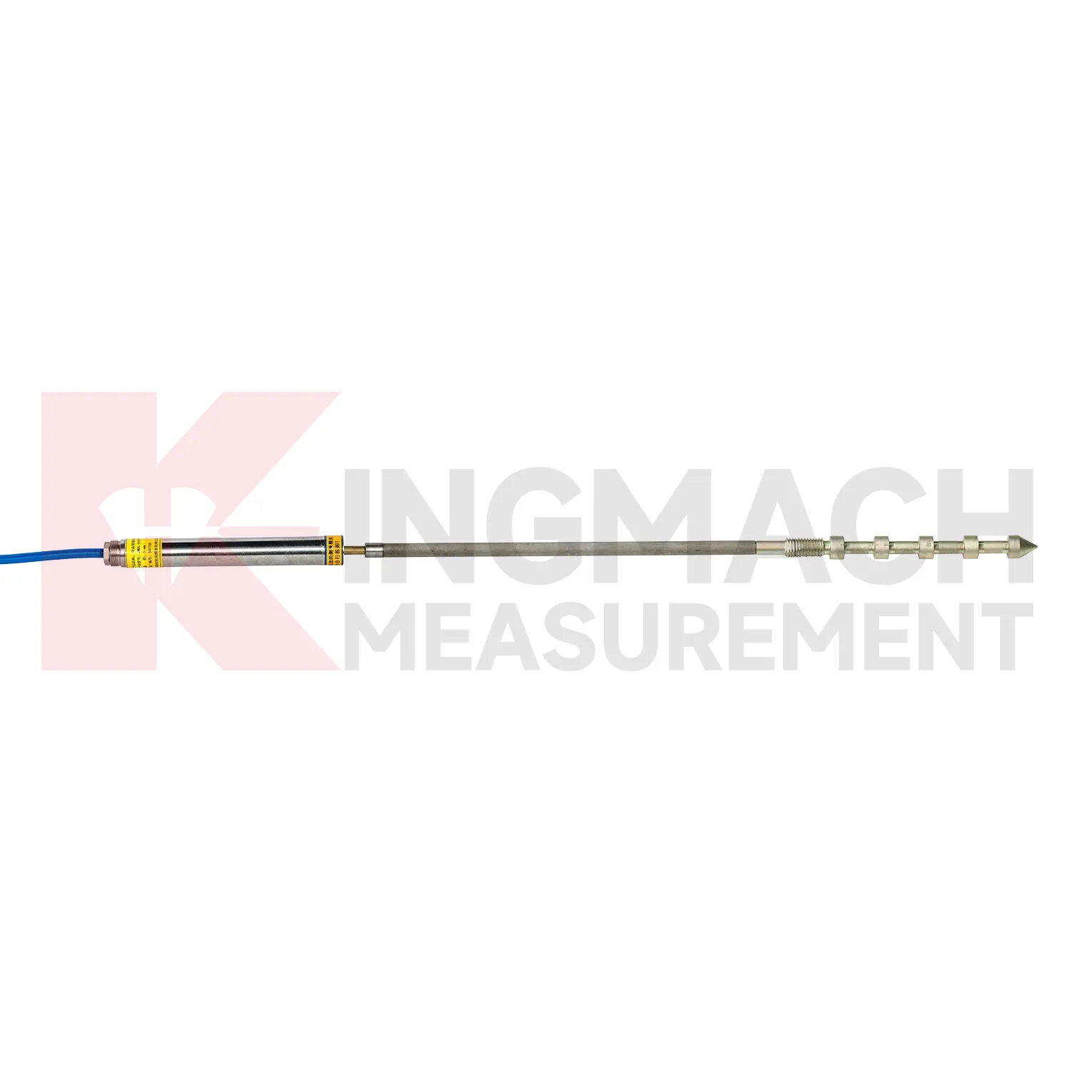
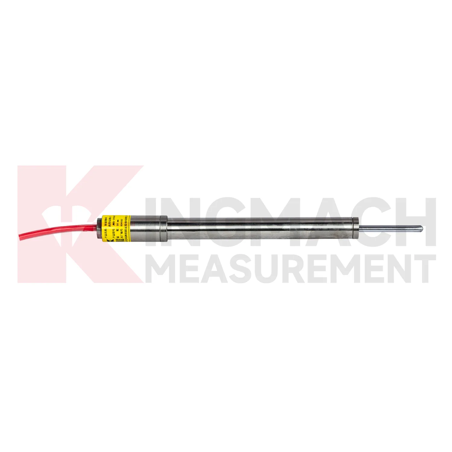
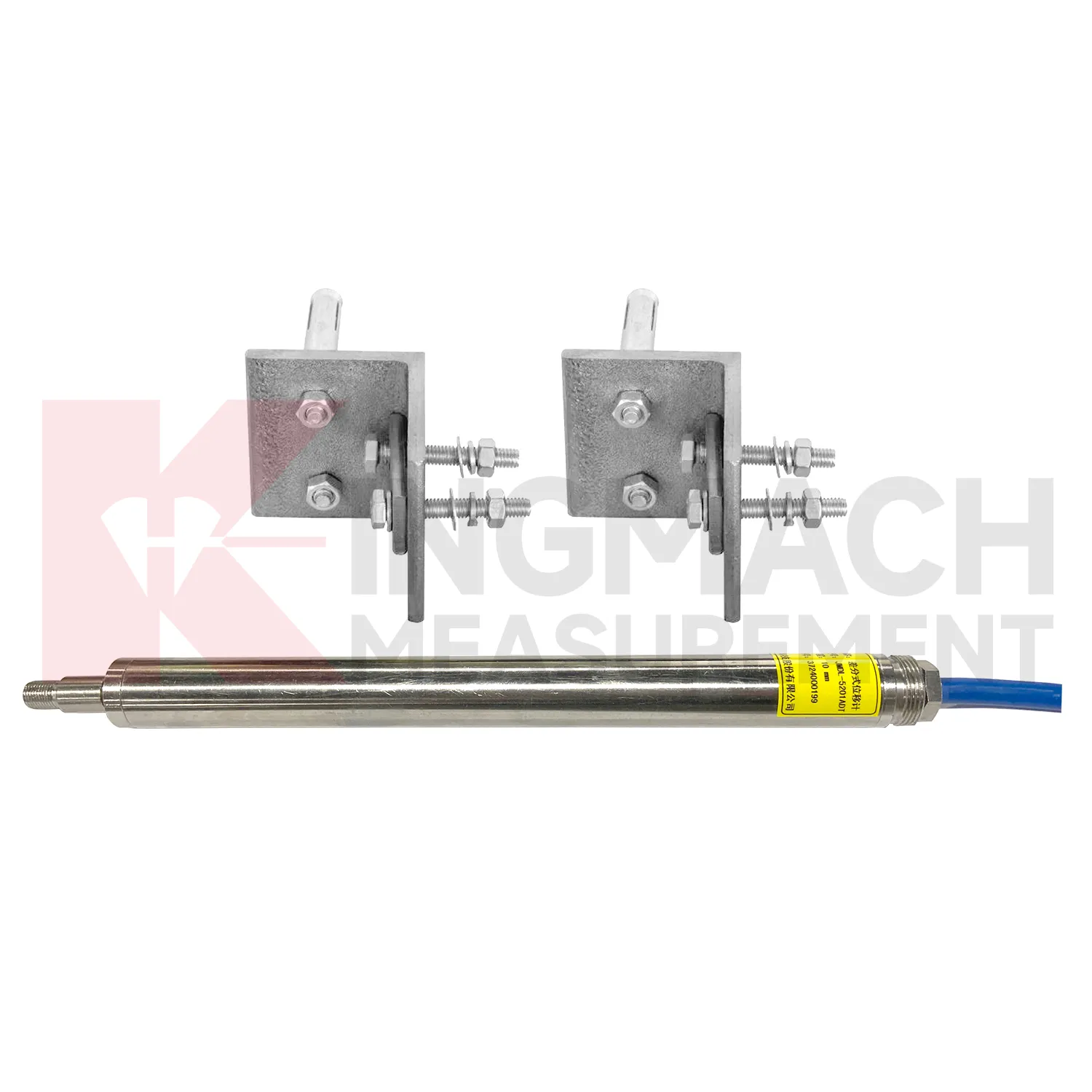
Kingmach Integrated GNSS include the JMDL-31XXAT Smart Multipoint Displacement Meter for tunnels, rock slopes, foundation pits, and surrounding rock layers. This product is not used like a surface joint gauge. It is built for boreholes where movement must be separated by depth. The instrument group includes displacement gauges, PVC measuring rod protective tubes, anchor heads, and multipoint installation kits that support three to five points. During installation, the borehole is prepared, anchor heads are set at selected layers, and grouting fixes each anchor to its target rock or soil zone. Listed models include 50 mm, 100 mm, and 200 mm ranges, all with 0.01 mm resolution. The sensing circuit changes output frequency as the measuring rod moves through the coil, so each channel can report how one anchored layer moves relative to the reference head. This layout is useful when tunnel crown movement, slope slip, or foundation pit deformation may start at one depth before it appears elsewhere. Field records should emphasize borehole number, anchor depth, grout condition, channel order, and the direction of expected movement. During later review, engineers can compare shallow and deep anchors to judge whether the deformation is local relaxation, progressive sliding, or full-section movement. That layered view is the main reason to use a multipoint instrument instead of several unrelated surface gauges.
Application of Integrated GNSS
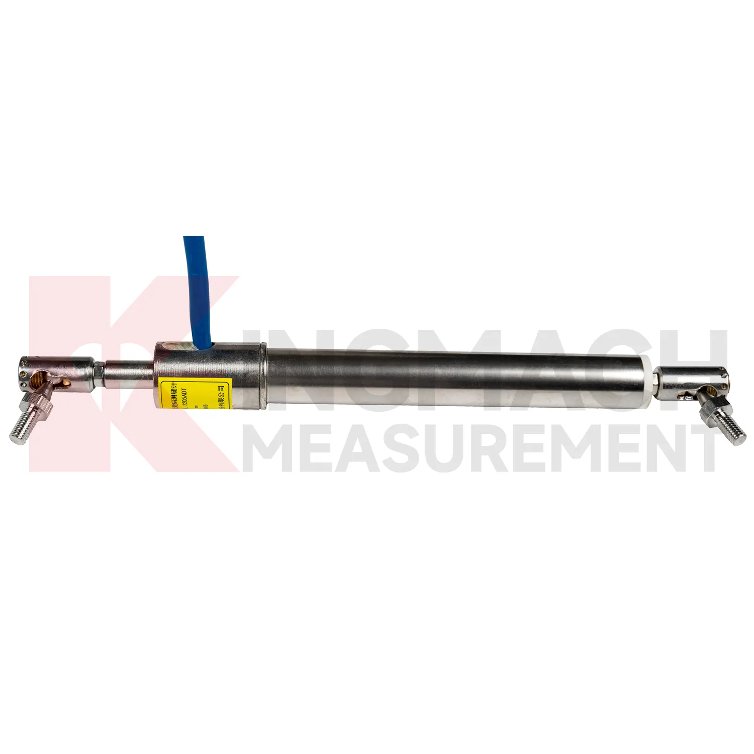
In industrial automation and equipment monitoring, Integrated GNSS are used for hydraulic cylinder stroke, machine tool positioning, gate movement, construction machinery displacement, and linear motion control. The site pain point is different from civil monitoring: readings must often be fast, absolute, repeatable, and resistant to wiring mistakes or mechanical wear. Kingmach JMCW-21XXADT magnetostrictive meters provide non-contact absolute displacement measurement over 0 to 1000 mm, 0.01 mm resolution, plus or minus 0.05%FS accuracy, RS485 communication, IP67 protection, average current below 60 mA, and reverse polarity protection up to -36V. For equipment with cable travel, JMLS-22XXADT wire rope sensors provide 500 mm, 1000 mm, and 2000 mm ranges with 0.2%FS accuracy and compact dimensions of 115 mm by 85 mm by 100 mm. These products help operators track position drift, stroke limits, gate opening, and machine movement in harsh workshops or outdoor installations. During operation, the monitoring team should keep the baseline, temperature, inspection notes, and nearby sensor behavior in the same review file. This makes it easier to tell whether a movement trend comes from normal service, a repair event, changing load, water influence, or developing structural risk. Clear records also help owners decide when a field inspection is needed instead of waiting for visible damage.
The future of Integrated GNSS
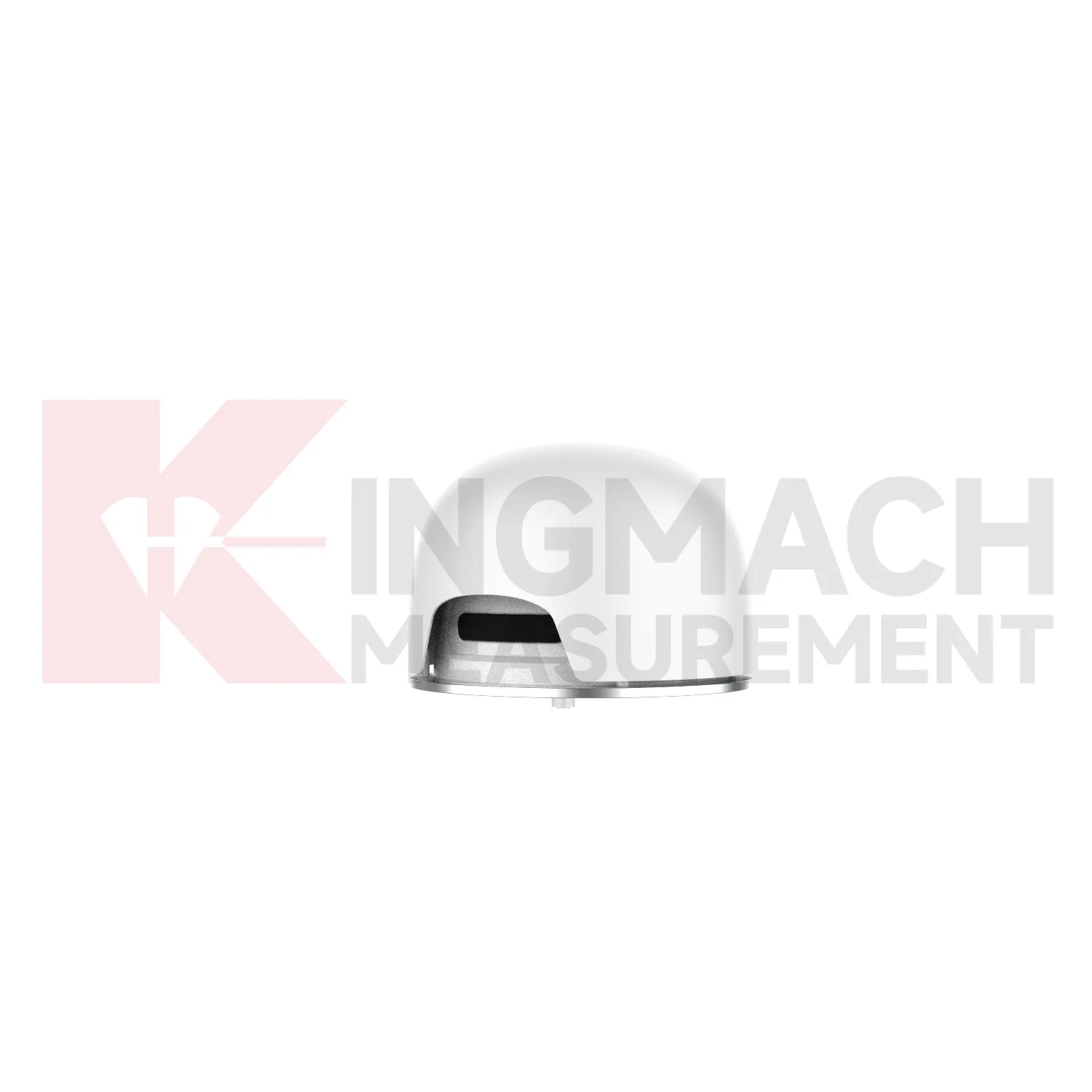
The future of Integrated GNSS in infrastructure will depend on better integration with digital twins and asset management records. A displacement reading becomes more useful when it is tied to a drawing location, construction stage, material zone, inspection photo, and repair history. Kingmach products such as JMDL-31XXAT multipoint meters and JMDL-32XXAT bedrock meters can represent movement at depth, while JMDL-52XXADT differential meters and JMDL-22XXAT crack gauges represent surface or joint movement. Future platforms can map these readings onto tunnel sections, dam galleries, bridge joints, or slope profiles, allowing engineers to see where deformation is growing. This is especially useful when movement is small but repeated. A millimeter trend may not seem urgent in one report, but over months it may show a clear relationship with rainfall, traffic, excavation, or water level. The strongest systems will still depend on careful installation, because digital tools cannot correct a loose bracket, wrong range, or poorly recorded baseline. Clear reporting will make displacement monitoring more useful for non-specialist decision makers while preserving the detail engineers need.
Care & Maintenance of Integrated GNSS
For automated Integrated GNSS, maintenance must include the whole data chain. A sensor can be accurate while the monitoring record is wrong because of channel swaps, wrong units, missed zero values, loose terminals, damaged power supply, or unstable communication. Kingmach displacement products may connect to comprehensive testers, bus modules, automatic acquisition systems, RS485 networks, and monitoring platforms. During commissioning, verify each channel by moving the sensor slightly or checking a known displacement point, then record direction, units, baseline, range, and warning values. During service, check whether data gaps match power failures, communication faults, storms, or cabinet maintenance. Keep spare connectors and labels for field work. When replacing a sensor, do not simply reuse the old zero value; record the replacement time, new model, serial number, range, calibration coefficient, and first stable reading. Keep the installation photo, point number, zero value, and expected movement direction with the commissioning record for later review. If a reading changes after maintenance work, inspect the base, anchor, cable, and cabinet before assuming the structure itself has moved.
Kingmach Integrated GNSS
Integrated GNSS are used when a structure needs movement data that can be reviewed, compared, and acted on before deformation becomes visible. Kingmach covers short range crack movement, expansion joint travel, rock layer displacement, geogrid deformation, draw-wire movement, and long stroke position tracking. The category includes JMDL-21XXAT general-purpose displacement meters, JMDL-22XXAT crack gauges, JMDL-24XXAT flexible meters, JMDL-31XXAT multipoint meters, JMDL-32XXAT bedrock meters, JMDL-49XXAT formwork meters, JMDL-52XXADT differential meters, JMCW-21XXADT magnetostrictive meters, and JMLS-22XXADT wire rope sensors. On site, this means one product group can cover bridge joints, tunnel portals, slope movement, dam deformation, railway subgrade settlement, and industrial linear motion. The value is not only the displayed millimeter reading. It is the ability to connect movement, time, temperature, construction activity, and warning limits into one record. The point should be named on the drawing, linked with its cable route, and checked against the expected movement direction before the first automatic reading is accepted. For daily review, the reading should be compared with nearby points, recent weather, site operations, and any loading event that could explain the movement.
FAQ
Q: What are Integrated GNSS used for?
A: They measure movement such as relative displacement, crack width, expansion joint travel, bedrock deformation, rock layer movement, geogrid deformation, formwork settlement, and equipment stroke.
Q: Which Kingmach models belong to this category?
A: Common models include JMDL-21XXAT, JMDL-22XXAT, JMDL-24XXAT, JMDL-31XXAT, JMDL-32XXAT, JMDL-49XXAT, JMDL-52XXADT, JMCW-21XXADT, and JMLS-22XXADT.
Q: What range should be selected first?
A: Start from the expected movement. Short joint monitoring may need 20 mm to 100 mm, while draw-wire or equipment travel may require 500 mm to 2000 mm.
Q: Can these products support remote monitoring?
A: Yes. Several Kingmach models support digital transmission, RS485 communication, automatic acquisition, integrated testers, or unattended monitoring systems.
Q: Why is the baseline reading important?
A: All later movement is compared against the starting point. The baseline should be recorded after the sensor, bracket, anchor, cable, and structure are stable.
Reviews
Joshua Clark
We ordered a full monitoring solution including sensors and data loggers. Everything works seamlessly together. Great supplier!
Ryan Lewis
Fast delivery and excellent product quality. The accelerometers and tiltmeters are highly reliable. Strongly recommend this company.
Latest Inquiries
To protect the privacy of our buyers, only public service email domains like Gmail, Yahoo, and MSN will be displayed. Additionally, only a limited portion of the inquiry content will be shown.
Ava***@gmail.comAustralia
Hi, I am looking for reliable tiltmeters and accelerometers for structural health monitoring. Please...
Emma***@gmail.comCanada
Dear Sir/Madam, we are interested in displacement transducers and settlement sensors for a geotechni...
Related product categories
- displacement sensor
- laser displacement sensor
- displacement sensors
- linear displacement sensor
- optical displacement sensor
- wireless displacement sensor
- laser displacement sensors
- non contact displacement sensor
- cable displacement sensor
- draw wire displacement sensor
- inductive displacement sensor
- lvdt displacement sensor