
 EN
EN
 ar
ar bg
bg hr
hr cs
cs da
da nl
nl fi
fi fr
fr de
de el
el hi
hi it
it ko
ko no
no pl
pl pt
pt ro
ro ru
ru es
es sv
sv tl
tl iw
iw id
id lv
lv lt
lt sr
sr sk
sk sl
sl uk
uk vi
vi et
et hu
hu th
th tr
tr fa
fa ms
ms hy
hy ka
ka ur
ur bn
bn mn
mn ta
ta kk
kk uz
uz ku
ku
Traversing Inclinometer
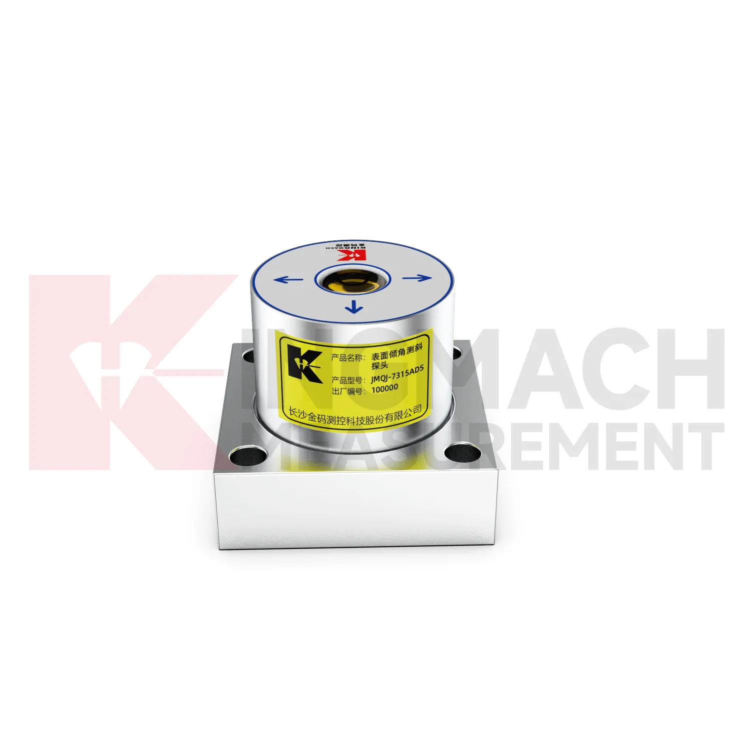
Range and accuracy are central when specifying Kingmach Traversing Inclinometer. JMQJ-7315ADS is listed with +/-15 degrees dual-axis range, 0.001 degree resolution, and 0.01 degree accuracy. JMQJ-7315RTU is listed with +/-30 degrees and +/-15 degrees dual-axis options, 0.001 resolution, and +/-0.05%FS accuracy. JMQJ-7915ATS provides dual-axis +/-90 degrees tilt range with 0.001 degree resolution and 0.01 degree accuracy for borehole monitoring. JMZX-7100L also uses a +/-90 degrees sensor range for sliding inclinometer work. These values should be matched to the expected deformation pattern. A bridge bearing seat may need small, stable angular tracking. A borehole in a slope may need a wider tilt range across several depths. A monitoring plan should also define alarm thresholds, data review frequency, temperature context, and comparison instruments.
Application of Traversing Inclinometer
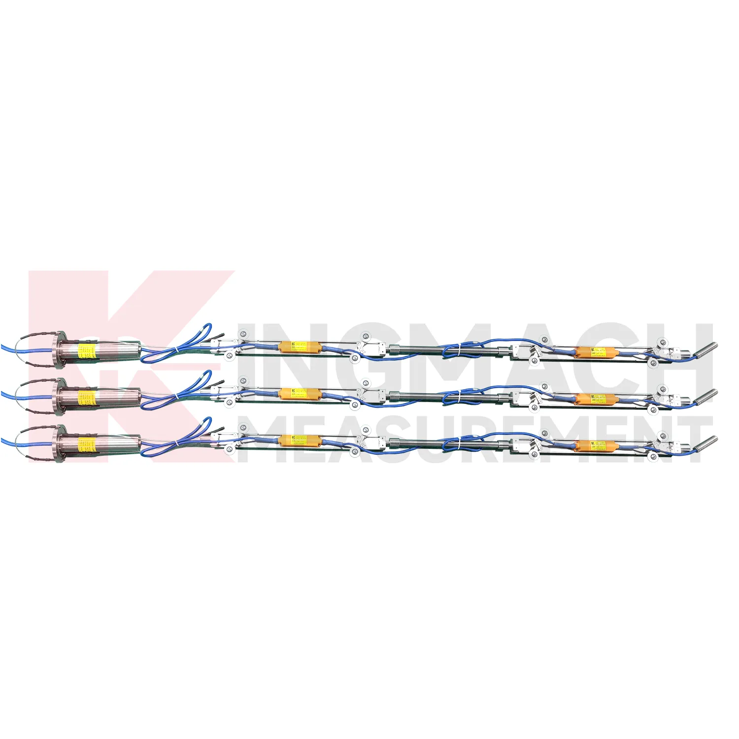
Port and underground construction projects use Traversing Inclinometer to follow soil movement, retaining structures, and deep displacement where surface survey alone is limited. JMZX-7100L is described for port engineering and underground construction projects, with Bluetooth communication, APP reading, large storage, and post-processing software. The sliding probe method is useful when engineers need a deformation profile along an inclinometer casing rather than one fixed surface angle. Field crews should keep casing ID, depth interval, probe orientation, reading direction, groundwater condition, and operator notes consistent. Data can then be compared with excavation, dredging, surcharge loading, pile work, or retaining wall movement. Good field discipline prevents a profile change from being confused with probe handling differences.
The future of Traversing Inclinometer
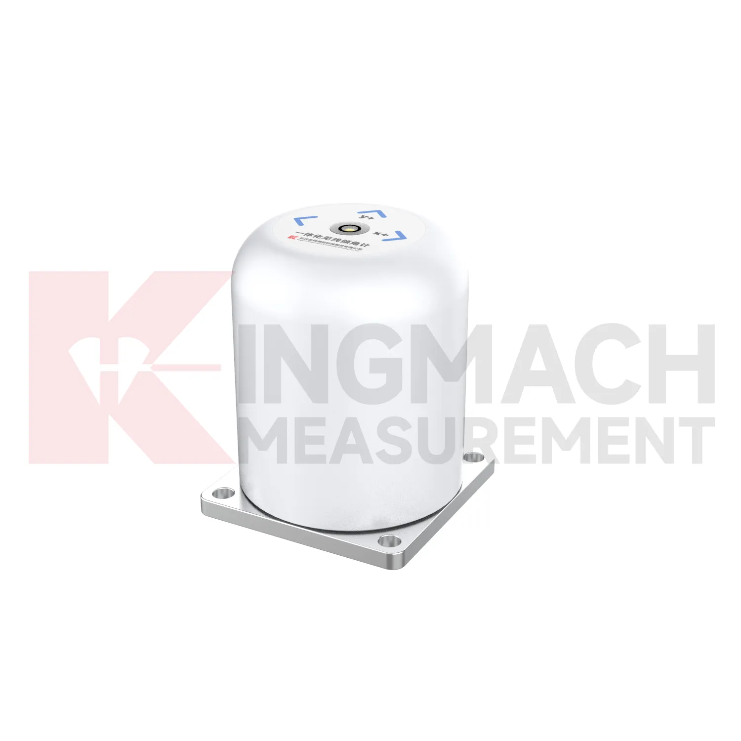
Manual and automated methods will continue to coexist in future Traversing Inclinometer programs. JMZX-7100L supports APP reading, Bluetooth transmission, large storage, data download, and post-processing software for sliding inclinometer surveys. Fixed products such as JMQJ-7315ADS and JMQJ-7315RTU support automated structural tilt monitoring. In practice, a site may need both. Automated sensors can watch key points continuously, while manual inclinometer profiling can confirm deeper deformation at scheduled intervals. Future monitoring plans should define how manual profiles and automated curves are compared, who reviews differences, and how field notes are stored. This mixed approach is useful in slopes, ports, foundation pits, dams, and underground works where access and risk change over time.
Care & Maintenance of Traversing Inclinometer
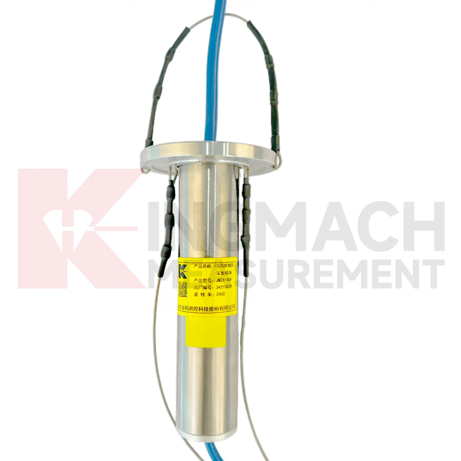
Waterproofing maintenance protects Traversing Inclinometer in tunnels, slopes, dams, foundation pits, and outdoor structures. JMQJ-7315ADS lists IP68 protection, JMQJ-7315RTU lists IP65, JMQJ-7915ATS lists IP68, and JMZX-4QH lists IP67. These ratings help, but glands, connectors, cabinets, tube orifices, and field splices still need inspection after rain, flooding, dewatering, or washdown. Look for moisture inside enclosures, damaged seals, corrosion, loose plugs, and cable jacket cuts. For borehole systems, keep the orifice module protected from mud and site traffic. Record waterproof checks with date, weather, fault, repair action, and next reading. That record helps engineers separate true angular change from water-related data disturbance.
Kingmach Traversing Inclinometer
Kingmach Traversing Inclinometer are also part of a larger structural health monitoring ecosystem. Tilt data becomes stronger when it is reviewed with displacement transducers, settlement sensors, strain gauges, load cells, accelerometers, water level sensors, environmental instruments, readouts, cables, and visualization software. For example, a slope warning may combine deep inclinometer movement, rainfall, pore pressure, and surface crack readings. A bridge review may combine tilt, deflection, strain, temperature, and traffic loading. A building review may combine column tilt, foundation settlement, cracks, and nearby excavation records. Kingmach product categories cover many of these instrument layers, so the tilt point can be specified as part of a complete monitoring plan. That reduces gaps between measurement, acquisition, reporting, and site response.
FAQ
Q: How accurate is the JMQJ-7315ADS tiltmeter?
A: The product page lists 0.001 degree resolution and 0.01 degree accuracy for the +/-15 degree dual-axis model.Q: What protection grade does JMQJ-7315ADS have?
A: It is listed with IP68 waterproof protection and an operating environment from -30 degrees Celsius to +80 degrees Celsius.Q: What range does JMQJ-7315RTU provide?
A: The integrated wireless model lists +/-30 degree and +/-15 degree dual-axis range options, with 0.001 resolution.Q: How many sensors can JMZX-4QH support?
A: The module lists four channels and support for up to 100 sensors in a multi-point inclinometer system.Q: What is the guide wheel spacing for JMZX-7100L?
A: The sliding inclinometer page lists a 500 mm guide wheel spacing reference and a +/-90 degree sensor range.
Reviews
Matthew Garcia
Instrumentation cables are durable and perform well even in harsh environments. Will definitely order again.
James Thompson
The tiltmeters and accelerometers are very sensitive and provide precise data. Perfect for our structural health monitoring system.
Latest Inquiries
To protect the privacy of our buyers, only public service email domains like Gmail, Yahoo, and MSN will be displayed. Additionally, only a limited portion of the inquiry content will be shown.
Charlotte***@gmail.comUnited Arab Emirates
Hi, we require instrumentation cables suitable for harsh environments. Could you advise on specifica...
Emma***@gmail.comCanada
Dear Sir/Madam, we are interested in displacement transducers and settlement sensors for a geotechni...